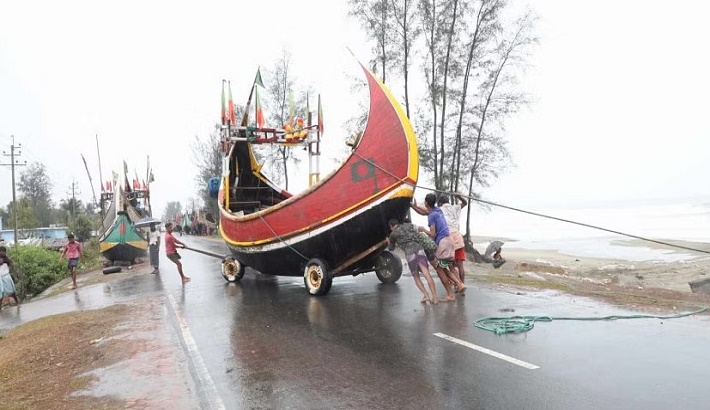
The peripheral effect of Cyclone Mocha will be felt in the coastal regions of the Chattogram and Barishal divisions from around midnight, said the latest weather bulletin of the Bangladesh Meteorological Department.
The cyclone was approaching the coastal areas of Bangladesh and Myanmar with a maximum wind speed of 200kmph, it said.
According to the bulletin, at 6:00pm, the very severe cyclonic storm was centered about 605km south-southwest of Chattogram port, 525km south-southwest of Cox’s Bazar port, 625km south of Mongla port and 565km south of Payra port.
It is likely to intensify further and move in a north-northwesterly direction and cross Cox’s Bazar-North Myanmar’s coast between 6:00am to 6:00pm tomorrow (May 14), according to BMD.
However, Indian Meteorological Department’s latest update said Mocha will cross southeastern Bangladesh and north Myanmar tomorrow with more lethal power riding a sustained wind speed of 180-190 km per hour gusting up to 210km per hour.
The maximum sustained wind speed within 74km of the very severe cyclone centre is about 180kmph rising to 200 kmph in gusts.
Under the peripheral effect of the cyclone and steep pressure gradient, the low-lying areas of the coastal districts of Cox’s Bazar and Chattogram and their offshore island and chars are likely to be inundated by the wind-driven surge height of 8-12 feet above normal astronomical tide.
The low-lying areas of the coastal districts of Feni, Noakhali, Laxmipur, Chandpur, Bhola, and their offshore island and chars are likely to be inundated by the wind-driven surge height of 5-7 feet above normal astronomical tide.